8329
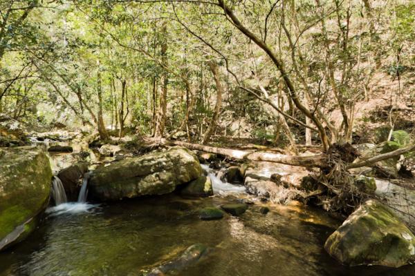
GBMWHE Kedumba Valley
by Aaron Spence taken on 16th September 2010
GBMWHE Kedumba Valley, New South Wales, Australia
Shot Details
- Photographer
Aaron Spence - Date Shot
16th September, 2010 at 1:24pm - Camera Nikon D700
- Lens '16.0 mm
- Shutter Speed 1/200 sec
- Aperture f/8
- ISO 200
Location Details
- Latitude -33.77533300
- Longitude 150.37266700
- Altitude 458m / 1502ft
- Street Federal Pass
- Suburb
- State New South Wales
- Country Australia
- Postcode
- Satellites 6
Other Details
- ID 8329
- Ranking 42/100
- Status Pending
- Last updated 9th November, 2015 at 5:54pm
Nearby Locations
GBMWHE Kedumba Valley
GBMWHE Kedumba Valley
GBMWHE Kedumba Valley
GBMWHE Kedumba Valley Track
GBMWHE Kedumba Valley Track
GBMWHE Kedumba Valley Track
GBMWHE Kedumba Valley Track
GBMWHE Jamison Creek
GBMWHE Jamison Creek
GBMWHE Kedumba Homestead
GBMWHE Kedumba Homestead
GBMWHE Kedumba Homestead
GBMWHE Kedumba Homestead
GBMWHE Jamison Valley
GBMWHE Kedumba Valley
GBMWHE Kedumba Valley
GBMWHE Leura Creek
GBMWHE Ruins
GBMWHE Ruins
GBMWHE Ruins


Popular Panoramas
Court of the Patriachs - Zion NP
Hill Inlet Lookout 0
Uluru 6
Darling Harbour
Shibuya Station 6
Malls Balls 1
Kings Canyon View
Barrow Creek
Hamilton Island
Daydream Island
Japanese Garden
Heron Bommie 0
Keruo
Bondi Beach foreshore 3
Kata Tjuta Sunset Viewing
Hamilton Island
Hayman Island
Sydney Harbour Bridge 11
National War Memorial 4
Kata Tjuta, Walpa Gorge 1


